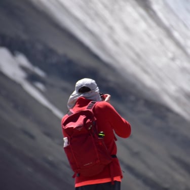
Lenin Peak expedition
A story on how and with what effort I reached the second highest peak of the Pamir mountain range, the 7134m high Lenin Peak.
Lenin Peak expedition
Lenin Peak is a 7134-meter high mountain summit located in the Pamir range on the border between Kyrgyzstan and Tajikistan. It is one of the most popular and well-known peaks in the Pamir, climbed by mountaineers via several routes. The first successful ascent was made by the German Allvein in 1928 from the eastern main ridge.
Expeditions usually start from the northern side, on Kyrgyzstan’s territory, as this is the customary and more easily accessible route. Technically, the mountain is considered one of the easiest seven-thousanders, making it suitable for beginners who do not have ice climbing skills, although good acclimatization and proper high-altitude equipment are essential.
Expeditions typically plan for 3-4 weeks, which includes acclimatization rotations. Climbers start from the base camp (BC) and proceed through several higher camps until reaching the summit. Fixed ropes and ladders are set up on dangerous sections, although marker flags often disappear due to wind and heavy melting, so following footprints is necessary.
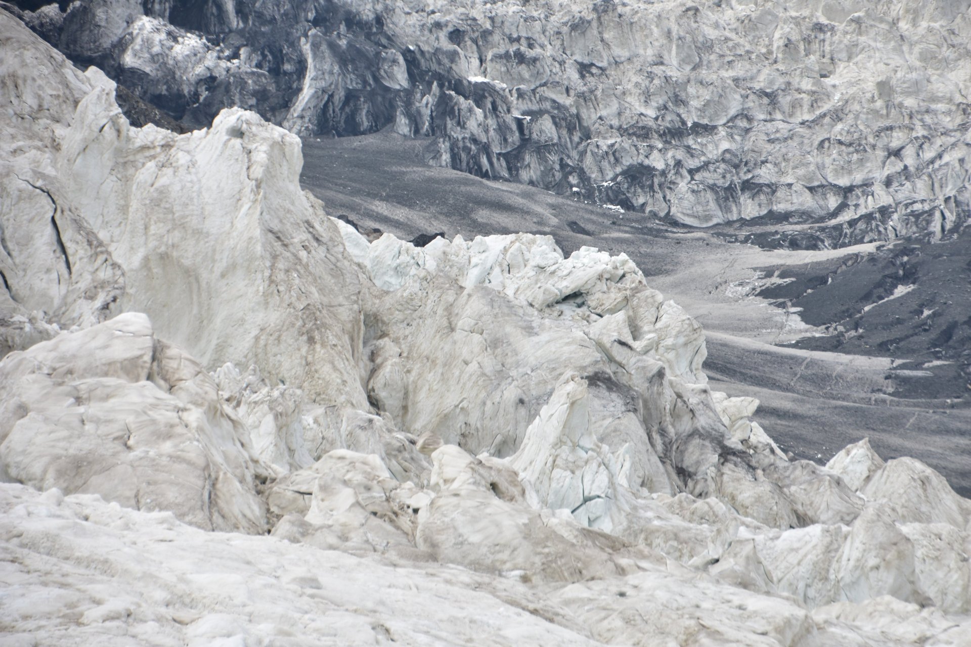
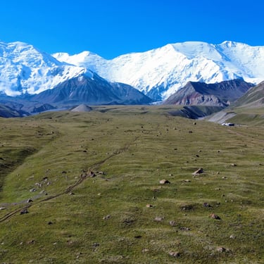
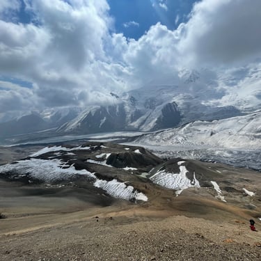
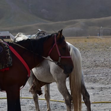
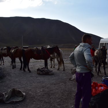
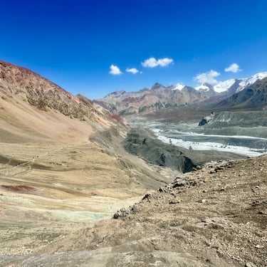
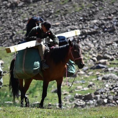
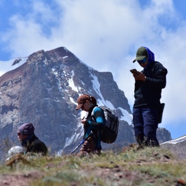
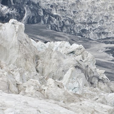
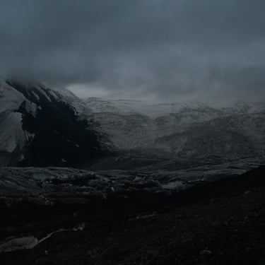
One of the most spectacular parts of the expedition is the Lenin Glacier, an impressive debris-covered area with fractured hanging glaciers and jagged peaks surrounding us. During the expedition, hikers cross intermittent streams and meet local Kyrgyz horsemen who provide help for tips. These horsemen transport packs, supplies, and various loads between BC and Camp One (C1).
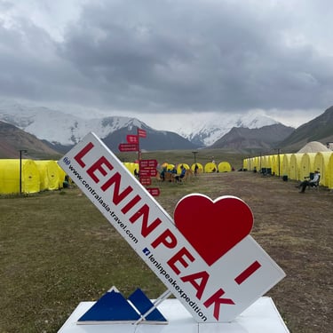
The Lenin Peak expedition is famous for now being the most affordable seven-thousand-meter peak to climb, attracting more climbers each year. The best period is between late July and early August, when the weather is most stable.
Hikers undergo great challenges due to the altitude and mountain conditions, but the immense power of nature and the summit experience remain unforgettable. Overall, the Lenin Peak expedition offers a technically simpler but high-altitude challenge, ideal for enthusiasts of elevation.
Lenin Peak expedition from my perspective
As I already mentioned on the main page, I first visited the Central Asia Travel base camp called Edelweiss Meadow at Lenin Peak (BC) back in 2022, which lies at an altitude of 3600 meters above sea level. So far, I’ve tried to reach the summit three times — twice unsuccessfully, and once successfully. I’ll only give a brief summary of the two unsuccessful attempts.
Now, let me share with you my successful 2025 expedition...
The Background
At the beginning of February 2025, I underwent a fairly complex ankle surgery.
The following three months were incredibly tough for me. I couldn’t do the kinds of training I truly enjoy — no heavy pack hikes, no stair climbing, no running, no hiking at my usual pace, no bouldering, no rock climbing.Even cycling was difficult at first — but there’s a big BUT.
I paid close attention to my physiotherapy and made sure not to overload my ankle. I was also extremely disciplined about my nutrition: I ate at least 1 kg of mixed vegetables daily, and I tried to avoid meat whenever possible to speed up the recovery process.
Early July – “Spaghetti Week” in Monte Rosa
This story deserves its own blog post, but to summarize briefly: I went trekking in the Monte Rosa range — which straddles the border between Italy and Switzerland — with a very dear friend of mine, Melitta.
She’s just as enthusiastic as I am, and she can keep up with my pace, so I don’t have to “drive with the handbrake on” in the mountains.
During our week-long hiking adventure, we summited a few 4000-meter peaks, laying the groundwork for my Lenin Peak climb.
The Expedition
These days, you can find countless mountaineering reports and vlogs on different platforms, which make it easier to visualize what such an expedition looks like. Still, I’m sure there are plenty of gray areas — and maybe even questions you wouldn’t think to ask.
The Questions...
Travel: How and with what? When? From where to where?
Costs: Plane tickets, food, insurance, medicine, vaccinations…
Duration: How many days? Where and how long?
Challenges: Weather? Temperature? Distance? Ascents and descents? Illnesses? Mental and physical struggles?
and much more...
Travel
I departed from Budapest to Istanbul on July 15th with Pegasus Airlines flight PC332 — a relatively quick 2-hour journey. Then came a 5-hour layover, which eventually stretched to almost 7 hours. That’s always the worst part of traveling — the endless waiting. After that, I flew from Istanbul to Osh, Kyrgyzstan, with Pegasus Airlines flight PC710. This leg was 5 hours of pure, cramped misery... but eventually, I arrived at the magnificent Osh Airport — which, to be honest, looks about as glamorous as the "Mucsaröcsöge" railway station back home.
Osh Airport
Once we got off flight PC710, we were quickly herded into the customs hall — literally pushed inside so they could close the door behind us. Sardines in a can. After such a long flight, everyone wanted the same thing: the toilet.
Fortunately, there was one for men and one for women. I can’t complain, but to be fair, “at least there was one” is about all the praise it deserves — it was like the latrine we once dug with Scout Troop 47, except this one was made of some sort of ceramic. Anyway, enough about the bathroom. After roughly an hour of waiting, I finally reached passport control.
Compared to my 2022 and 2024 trips, there was one key difference — the officers now spoke English! That meant things went a lot faster. They saw I’d been there a few times before, so I got my stamp right away.
Do you need a visa?
Since July 25, 2012, Hungarian citizens can travel to Kyrgyzstan visa-free for up to 60 days.
Your passport must be valid for at least six months beyond your planned departure date. (https://1000ut.hu/vizumok/kirgizisztani-vizum)
Osh, the “Southern Capital”
After the security check, I exchanged some money and bought a Megacom SIM card in the arrivals hall. As soon as I stepped outside, I was swarmed by taxi “dealers”… but that didn’t surprise me anymore. I quickly found a ride into Osh city, to the big supermarket Globus.
That’s where we usually stock up on food and drinks for the expedition before heading to base camp with the Central Asia Travel minibus fleet. The 14 km ride cost me 700 Kyrgyz SOM — though with Yandex it would’ve been about half that.
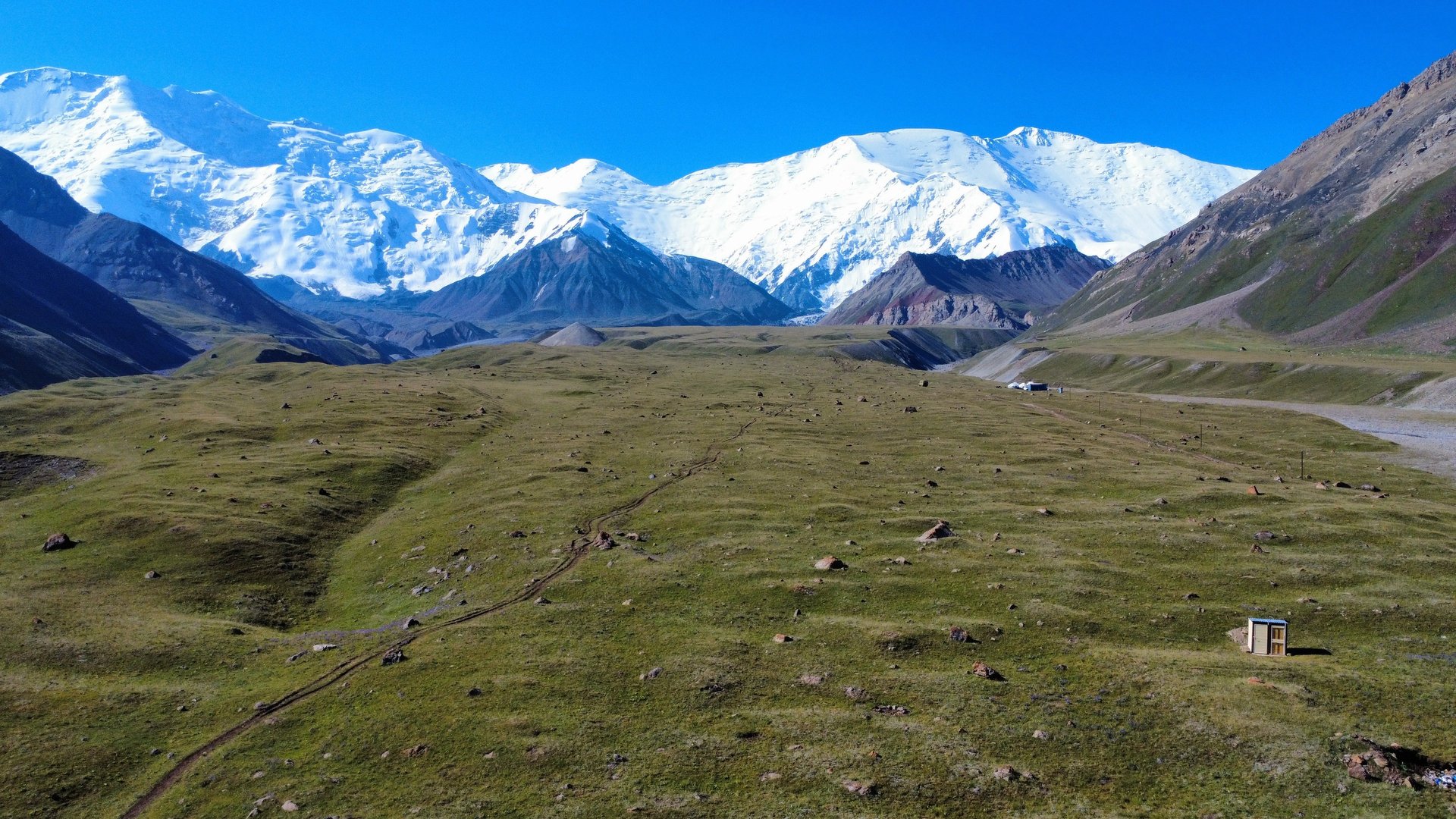
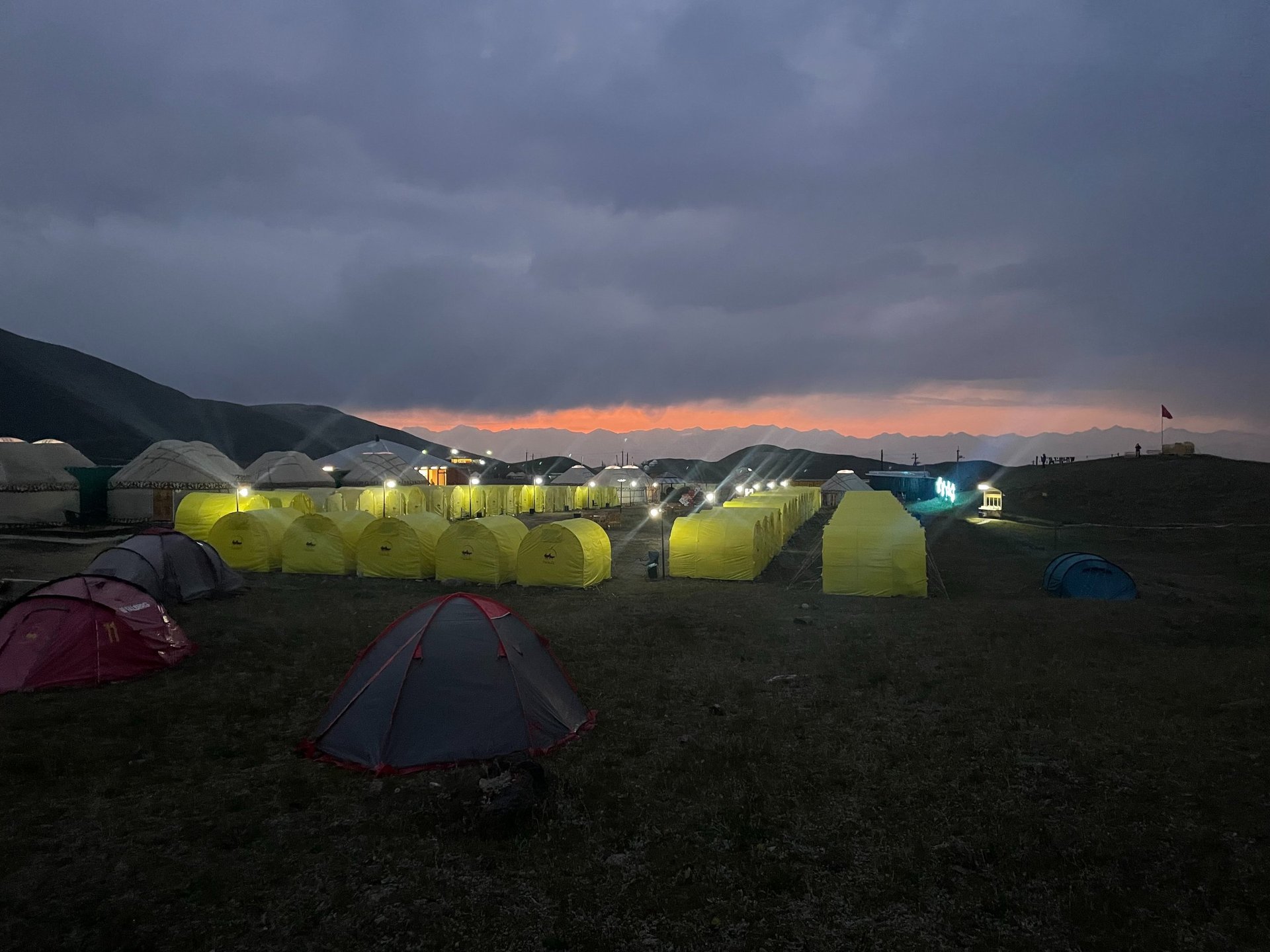
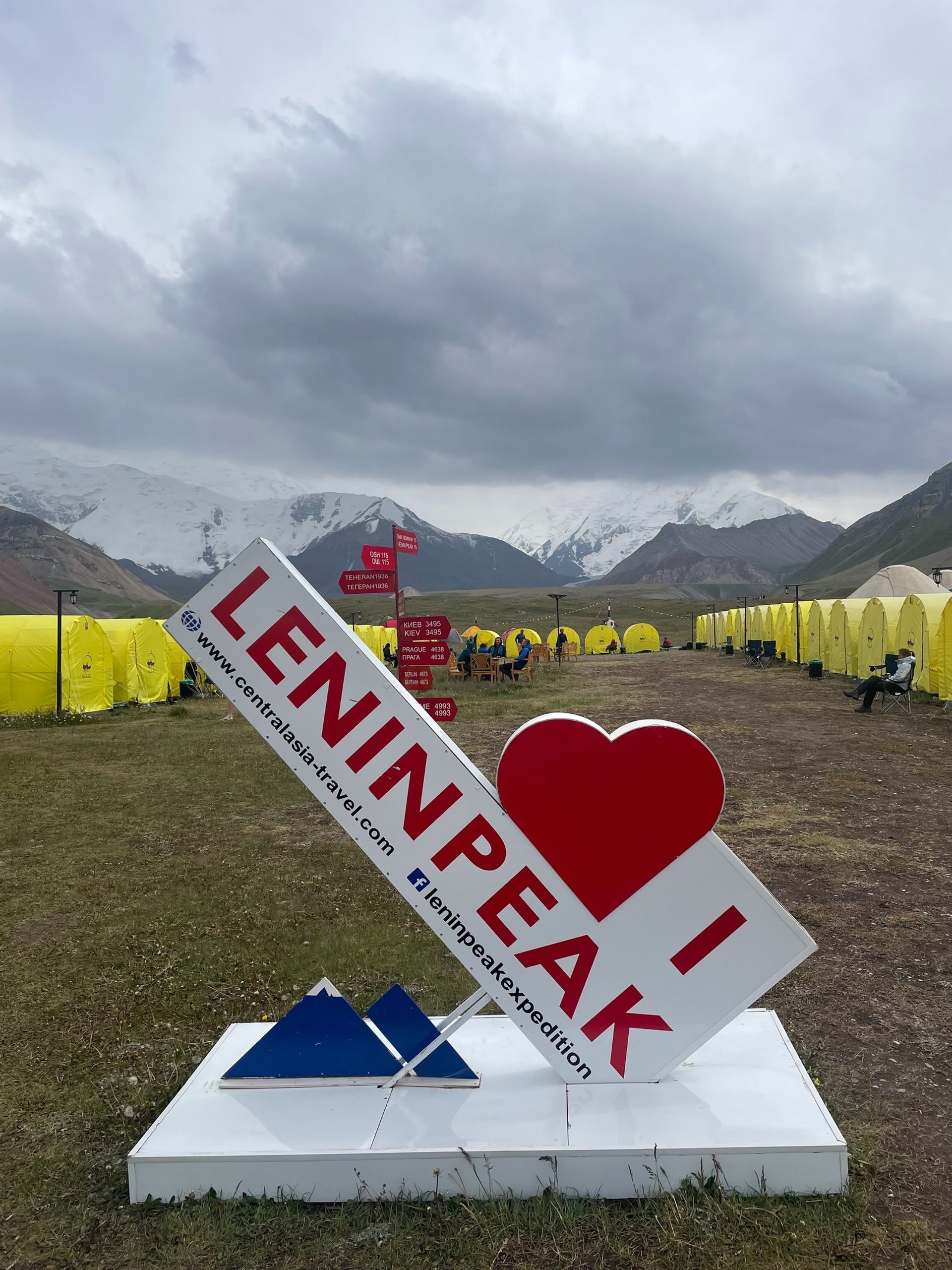
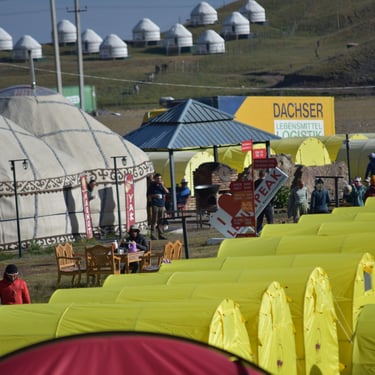
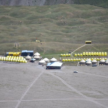
Base Camp (BC)
The Edelweiss Meadow base camp sits at 3600 meters above sea level — funny enough, you can’t drive that high anywhere in Europe, but here you can. Vehicles even go up to around 3800 meters carrying groups and gear. And the road to BC? Absolutely stunning. The air is so clean it feels like being inside a Kärcher WD 4 vacuum cleaner. Ahwww 🤣 Six hours of cramped, dusty, bumpy chaos in an old Mercedes Sprinter — swaying, pressed up against strangers through endless switchbacks. But honestly, it’s worth it — that’s how a small team really bonds 🤣 Because of roadworks, we even got a chance to stretch our numb legs for a bit, admiring grazing goats and a Hyundai excavator in the distance. After the long wait, we hopped back into our “luxury” Sprinter and finally reached base camp.
Leaving the asphalt behind, crossing steppes, streams, and choking dust storms, we finally spotted the ever-growing Edelweiss Meadow camp. As soon as I stepped out, I noticed our driver tightening the wheel bolts — every single one had come loose. That’s when I really appreciated that we’d made it safely.
The way to Camp 1 (C1)
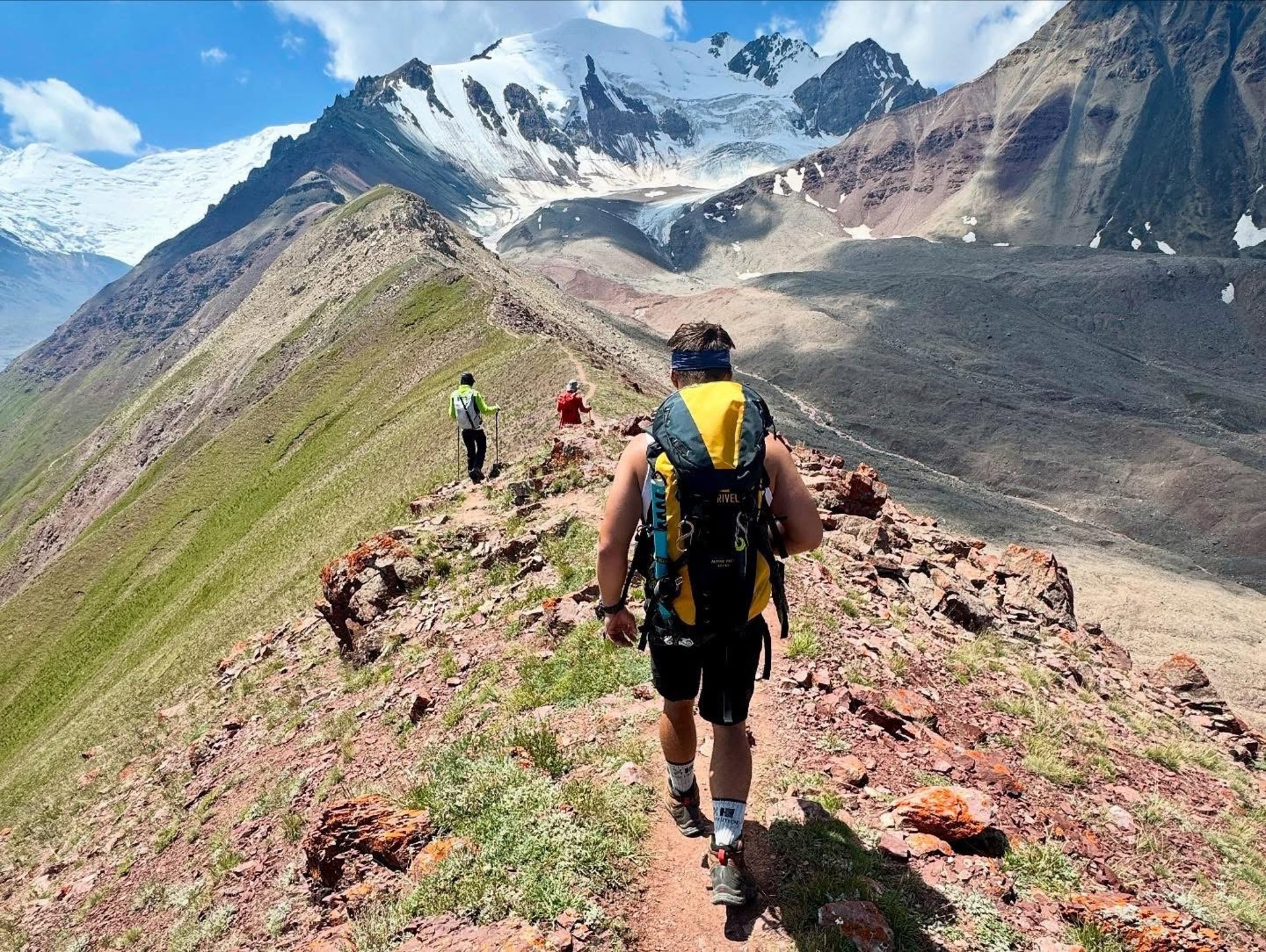
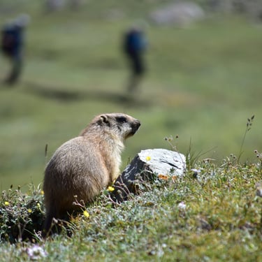
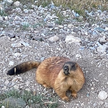
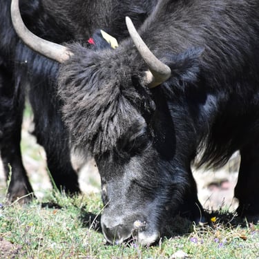
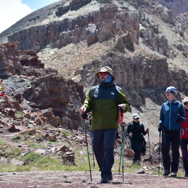
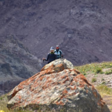
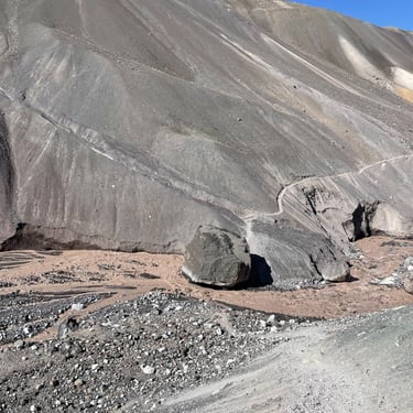
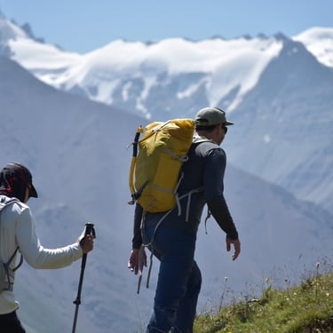
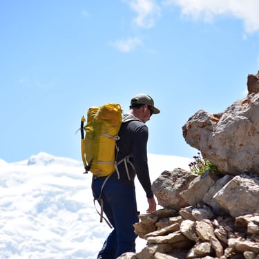
The trail to Camp 1 is roughly 12 km long and includes about 900–1000 meters of elevation gain. The landscape changes dramatically along the way, glowing with vibrant shades of green, brown, rust-red, and grey. I’d divide the route into four sections. The first section is about 4 km long, taking you up to around 3800 m. This is where the area known as The Onion Field begins — you’ll also find a beautiful waterfall here. It’s a great spot for a longer rest. Along this stretch, you’ll likely encounter yaks and marmots roaming freely.
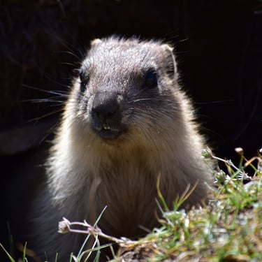
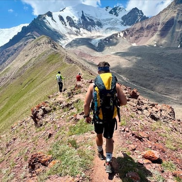
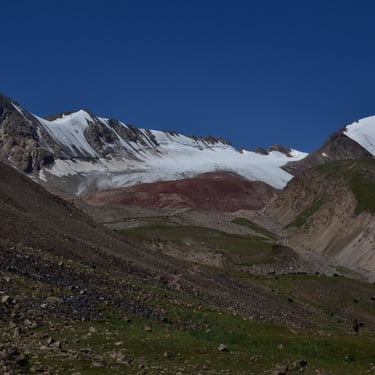
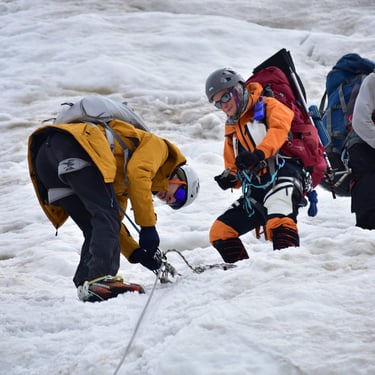
The next section is about 3 km long, leading up to the Puteshestvennikov Pass at around 4150 m. The green meadows slowly give way to a rust- and grey-colored clay landscape. The hardest part of this segment is the last 300–400 meters, which packs in another 200 meters of elevation gain. The slope becomes steep suddenly, forcing you to zigzag your way up. Sometimes this part is already covered by a thin, melting snow layer, making the climb slippery and slow. It’s definitely worth taking another break here — the view that unfolds is simply breathtaking. A few meters below, you can see a small grassy patch where marmots play, and in the background, you’ll spot the Lenin Glacier and towering, snow-covered peaks such as Spartak Peak (6183 m), Unity Peak (6690 m), and of course, Lenin Peak, our main objective. The third section starts with a 100 m descent, which can be quite demoralizing because you know there’s still a long way to go to reach C1. The trail gets rougher here. Everything is covered in crumbly, powdery shale — if you’re not wearing gaiters, your boots will quickly fill up with debris. Not a pleasant feeling. As you walk along the narrow mountain paths, you can see bits of rock constantly sliding down from the slopes beside you — tiny, splintered fragments clattering down. In some places, small streams of meltwater cross the trail, turning into little rock rivers. Crossing the barren, stony wasteland, you finally reach the end of this section — only to face a strongly flowing glacial river. It had widened so much that we had to make an 800 m detour to cross safely. Then comes the final section, which seems easier — but isn’t. It starts with another sudden steep climb, followed by a gentle slope that tricks you into thinking “okay, this is fine now” — and that’s exactly when the suffering begins. You descend into a river valley, climb up again, then down once more onto a glacier field, then up a slick, ice-covered “hill,” and down yet again to another icy plain. After one last uphill push, you finally arrive at Camp 1 (C1). (Just reading this is exhausting — imagine actually doing it 🤣)
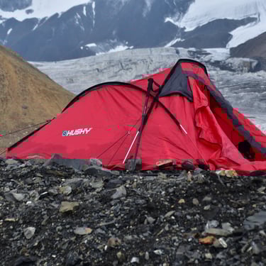
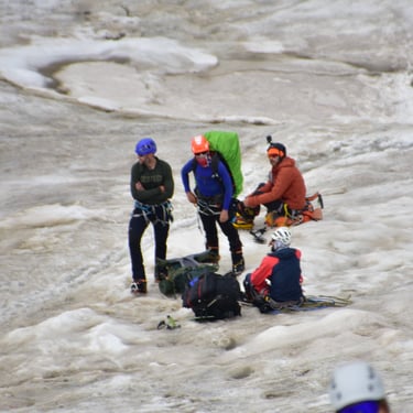
Life in Camp 1 (4400 m)
Ah yes, the beautiful Camp 1… a “safe haven” made up of yellow tents, metal containers, and a kitchen and dining yurt, sitting on a black sea of rocks waiting for mountaineers. There’s a medical tent with a trained doctor, and across from it lives Vladimir, the expedition coordinator. But what are the living conditions actually like? Let’s just say… I really didn’t enjoy staying here. It’s probably the easiest place on the mountain to catch some kind of infection. Initially, the camp had two, later four pit toilets, each built right above a glacial crevasse — so you could literally “flush” your creation by gravity. But as the glacier melted more each day, those crevasses grew shallower, and… well, things stopped disappearing so easily. And people’s aim wasn’t exactly perfect either, so the plank you stood on was often covered in… yeah, poop. It’s no wonder gastrointestinal issues were so common (vomiting and diarrhea outbreaks happened regularly). Honestly, the toilets weren’t even the biggest problem. The real issue was the so-called mountaineers themselves. Out of laziness and sheer disregard, some people just relieved themselves right next to the tents — and if that wasn’t bad enough, they also dumped their leftover food all over the place. The ground in camp is covered with sharp rocks that can easily pierce through the soles of your boots or slippers. Combined with the filth, even a small cut could get infected — potentially ending your expedition right there.
But to be fair, it’s not all bad. As I mentioned, there’s a kitchen and dining yurt, where professional Kyrgyz chefs cook for the hungry climbers, Sherpas, and horsemen. Of course, it’s not free — each meal costs $15, but considering the location, that’s quite reasonable for a three-course meal. The dining yurt is also our social hub — a cozy refuge warmed by the stove, where we can play cards, backgammon, or chess, and for a while, forget the harshness of the environment outside. And then there’s the view — the strongest positive of all. Absolutely magical.
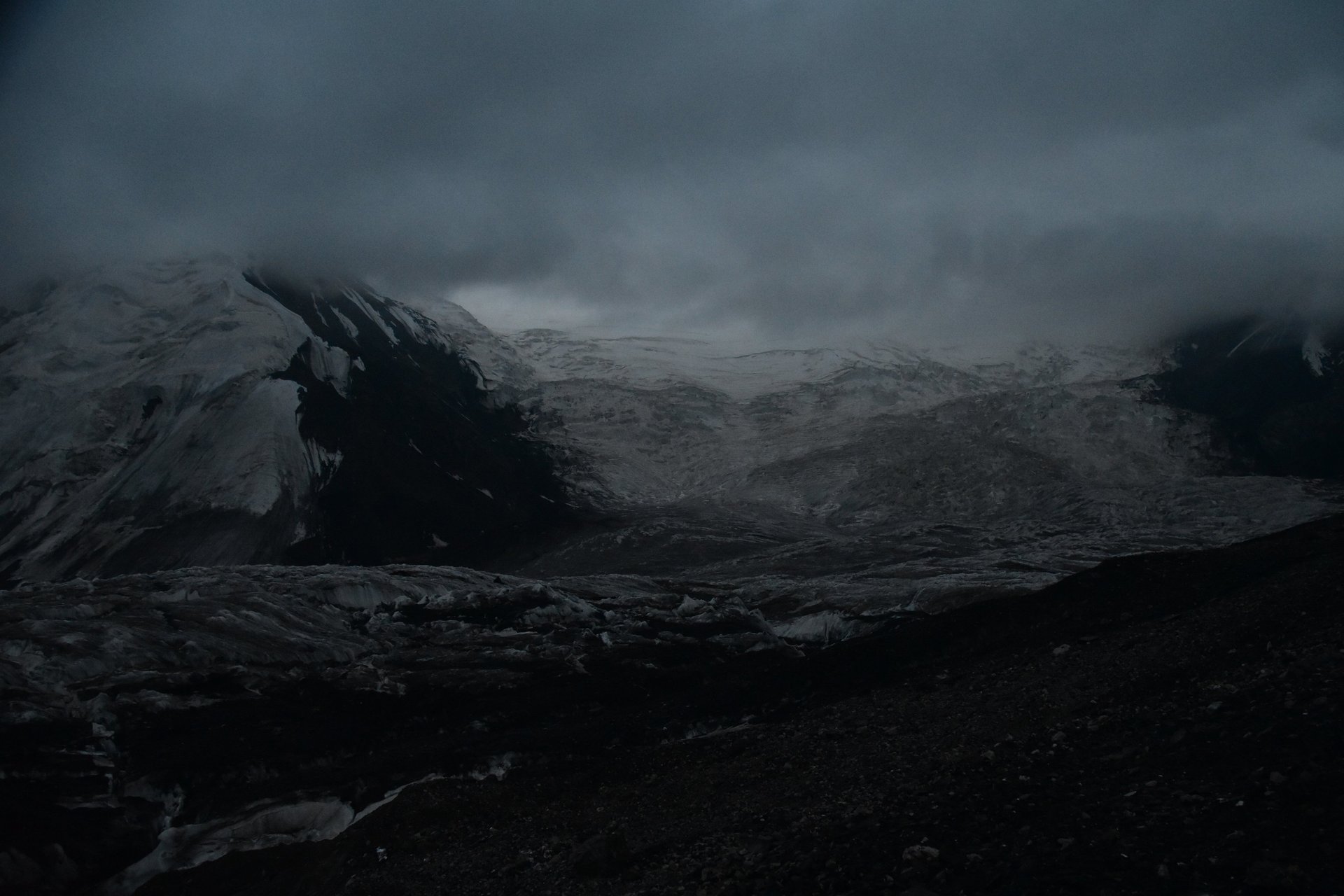
Everywhere you look: towering, snow-covered peaks; the vast Lenin Glacier (13.5 km long, 55.3 km² in area); and streams of meltwater snaking through the ice and rock — a sight that never gets old.
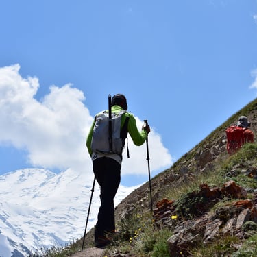
The way to Camp 2 (C2)
Pure excitement, mystery, and fear…
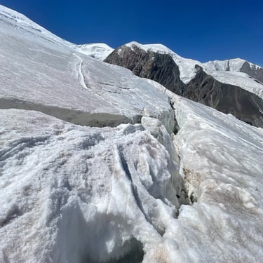
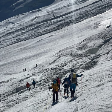
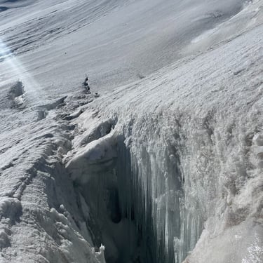
The first time you see the immense glacier field stretching ahead, with towering ice peaks rising in the distance, your skin starts to tingle. You’re about to step into the unknown — a trap of hidden dangers. The tension is amplified by the constant thunder of distant avalanches and rockfalls. The night before our planned ascent, a massive avalanche swept across the very route leading to Camp 2. Naturally, there was a quiet sense of fear within everyone, growing stronger as we approached the avalanche zone. And besides the visible dangers, there were plenty of invisible ones — snow-covered crevasses waiting beneath our feet. It’s best to start this route around 3–4 a.m., when the snow is still firm. The distance is about 5–6 km, and I’d divide it into four sections. The first section is around 2.5 km long, following the Lenin Glacier up to the fixed ropes at 4700–4800 m. The trail is well-marked with flags and relatively safe. Then comes a more exciting part — the fixed rope section, equipped with ladders, plank bridges, and rope railings. Here, you can get a close look at the deep, menacing crevasses, some so deep you can’t see the bottom. This stretch is short, only about 1–1.2 km. Next is a short but dangerous zone filled with hidden crevasses — this is also where the avalanche-prone area begins. From my observations, this is the only section of the normal route where avalanches have actually swept across the path. It’s the shortest section, just 400 m, but also the most terrifying. Finally, you reach the last big climb up to 5150–5200 m, from where you can already see the safety of Camp 2. From there, it’s just one last hard push through the so-called “Frying Pan” — and yes, the name says it all. It’s hot. But it’s not much different in C2 either… finally reach camp, overjoyed — but that happiness lasts only a moment. Why? Well, you’ll see in the next part. 😉
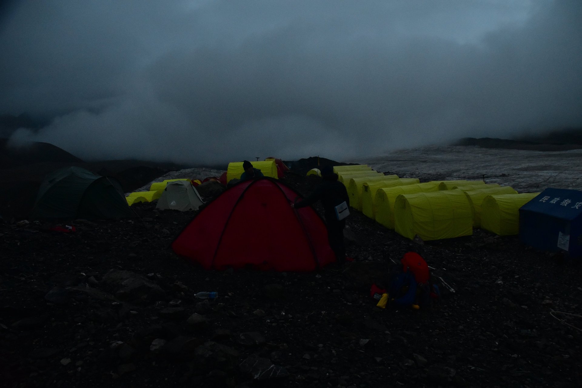
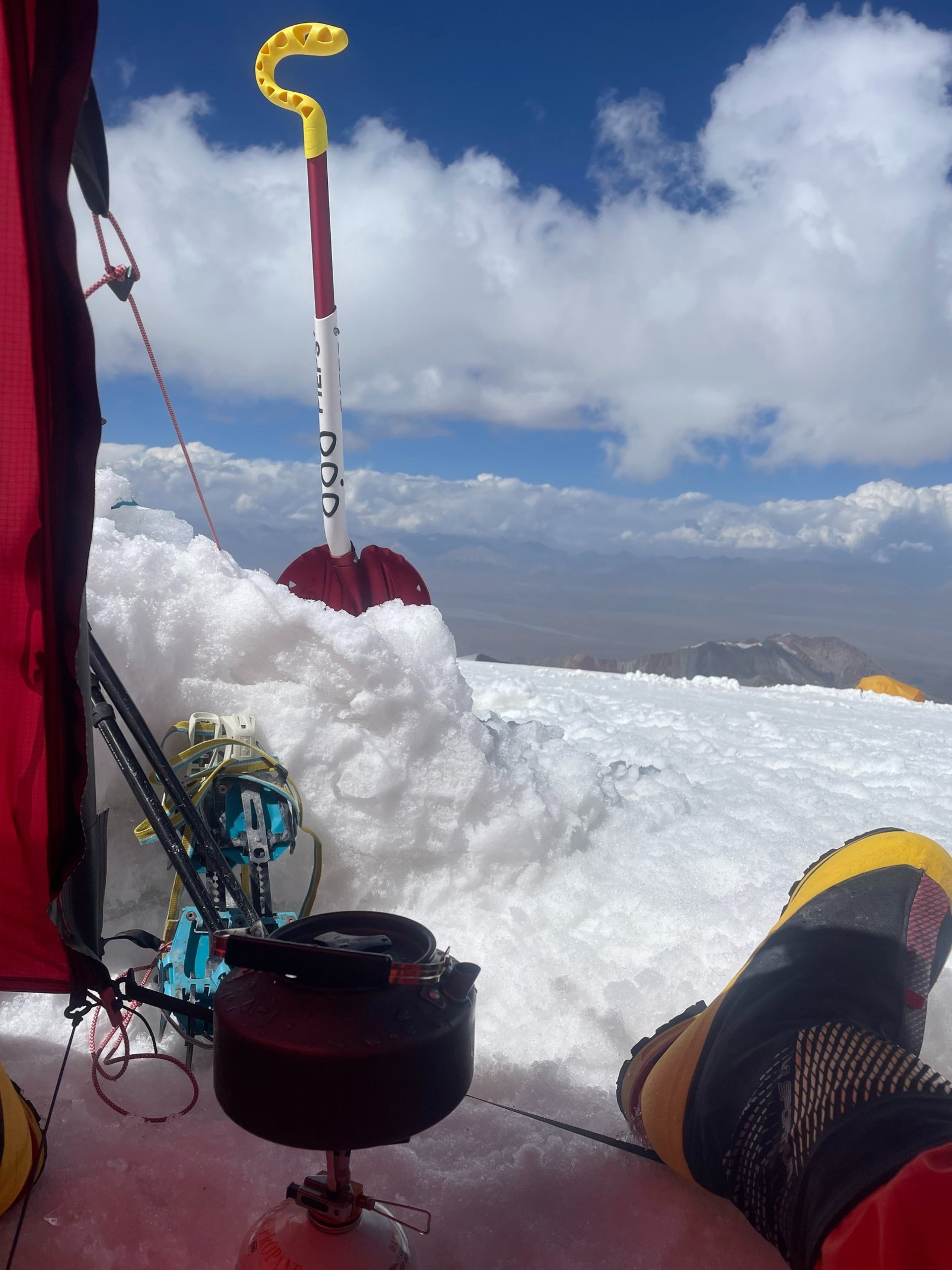
Life — or Rather, Survival — at Camp 2 (5300 m)
Here we are at C2 — a crowded maze of expedition tents from different companies, giving the illusion of safety, but not much more than that. The camp changes shape almost daily. Because of the melting ice, by the afternoon the tents often lose the solid snow, ice, and rock foundation beneath them — they’re actually pitched on top of hidden ice caves. There are very few truly safe spots to set up a tent. During my expedition, I even heard about a German team that woke up a few meters lower than where they’d gone to sleep — because their tent had collapsed into an ice cave overnight. I honestly have no idea how I’d react in that situation 😅. (I’ve posted a few videos on my Instagram showing how C2 changed over the course of the expedition.) What other problems might you face here? Crevasses run right through the camp itself. Many climbers are too afraid to walk far, so they just… handle their “bathroom business” next to their tents. The official toilet is higher up, on a big rock with a stunning panoramic view of the C1–C2 route. Of course, that also means anyone walking below gets a lovely view of your backside — but hey, we’re in extreme conditions here. Time to let go of a little comfort and reconnect with our primal ancestors! Unfortunately, not everyone respects cleanliness. On the far side of camp, there’s a small stream where we refill our bottles with fresh water (which you should boil or disinfect). In previous years, I never saw anyone pollute this area. But this year… it was different. People dumped leftover food, urine, and even baby wipes into the water source. I was honestly disgusted. I couldn’t wait to get away from that place — so I decided to move my tent and all my gear up to the advanced Camp 2 as quickly as possible.
The way to Camp 3 (C3)
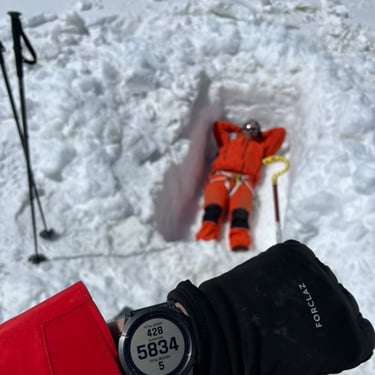
The route between C2 and C3 is the shortest of all — only about 2.5 to 3 km long, with an elevation gain of roughly 800 meters. Because of the intense melting and strong UV radiation, it’s best to start before 8 a.m. That’s when the snow and ice layers are still solid and stable — at least for the first 300 meters of ascent and the initial 500 meters of distance. After 10 a.m., this section can become dangerously unstable: narrow ice bridges start melting, and the snow layers turn slippery and treacherous. From that point on, it’s just a “relaxed” walk — until you reach the Advanced Camp at around 5750–5800 meters.
The trail is only about 500 meters long, but suddenly it steepens to 30–45° and beyond.
The Advanced Camp (C2.5 – 5800m)
This is the famous “advanced camp,” or C2.5 as we call it. It’s best to pitch your tent here or dig a small snow bivouac, because the nights are much calmer in this spot. It’s wind-sheltered, quiet, and clean. During the first acclimatization round, it’s smart to climb up to C3, then descend back here and spend the night.
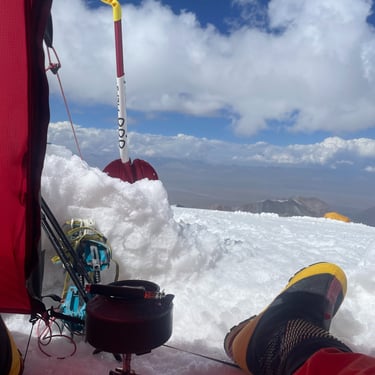
Camp 3 — A Place You Don’t Want to Stay Too Long (6100m)
Once you arrive at C3, you immediately feel the force of the raging wind — but also get rewarded with a stunning panorama. Writing these lines now, I can almost feel as if I were back there again. Most climbers only spend two or three nights here during the expedition. I don’t get them — and they don’t get me 😅. I’m quite the opposite. During this year’s expedition, I spent seven nights here in total, including four in a row — counting the one after the summit push. From 9 p.m. to 9 a.m., the wind is usually brutal, and the wind chill hovers around –20°C. But let me paint the scene a bit: C3 is beautiful in its own way — neatly arranged tents, snow-walled toilets (though, of course, many people preferred to do their business wherever they felt like it... making it hard not to drink someone else’s melted pee 🤢). Just a few hundred meters away rises Razdelnaya Peak (6148m) — a small dome really, barely noticeable if it weren’t for the tiny memorial plaque at the top. Yet the view from there is absolutely mind-blowing. The vast Tajik mountain sea stretching out beneath you is something you should never skip witnessing. 😉
The Summit Push (7134m)
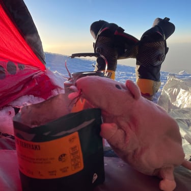
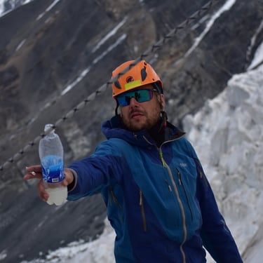
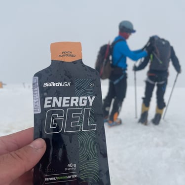
August 9, 02:30 a.m. The wind was hammering the walls of my tent. I was ready — ready for the moment the frame would finally snap and my fragile shelter would collapse around me. I spent the night in my Millet down suit, to make the early start easier. My La Sportiva G2 boots were tucked inside my sleeping bag, soaking up my body heat. I melted snow, mixed it with isotonic powder — a gift from my friend Eliezer (Thanks, bro!) — and poured the warm drinks into Coke bottles, which I stuffed back into my boots while I gathered my courage to leave the tent.
03:00. I was still inside, hiding from the storm. The wind only got stronger. I started to let go of the idea altogether. I ate my last pack of coffee–muesli mix, given to me by a Spanish team at the beginning of the expedition. The package had a sad face drawn on it. They told me that everyone who ate that one never made it to the summit. The happy-face version, they said, was the “lucky charm.” I didn’t care — I had no other muesli left. The caffeine hit fast — my body hadn’t seen that much coffee in days. I lay back for a moment, trying to gather energy. I pulled on my boots and crampons, occasionally peeking outside to check the weather. I saw a group already heading out...
04:00. The wind seemed to ease a little. I taped my nose with kinesiology tape to protect it from the cold, took a few sips from my Coke and isotonic drink, and finally crawled out of the tent. My watch showed 04:30.
For a second, I froze — not from the cold, but from shock. The wind hadn’t weakened at all; it had just paused briefly to strike harder. Vum-vumm-vummm! It slammed into my face like a hammer. The cold cut straight to the bone. And so, I went. I couldn’t stop — I had to leave camp. It was comforting to see that I wasn’t alone. I knew the route well; I’d done a short acclimatization walk on it a few days earlier. Ahead of me, two climbers were staggering along — in the wrong direction. I rushed toward them just as one of them broke through a snow bridge. Luckily, he wasn’t hurt. I told them to follow me and showed them the safe route along the ridge. The only path was through the saddle, where gusts over 100 km/h made breathing nearly impossible. Our goal was the so-called “Camp 4”, a non-existent bivouac spot at 6400m — just 1.2 km and 500m of ascent. That’s all that stood between us. The wind was relentless. We kept stopping, sitting with our backs to it just to catch a breath. Then I saw the large team that had left at 3 a.m. — they were turning back. That was worrying, but we didn’t stop. The Polish climbers rested behind a rock, so I went over and — to their surprise — pulled out a bottle of sugary Coca-Cola. We passed it around, laughing. One of them had icicles hanging from his mustache, frozen snot and all — quite a sight. We kept going. The sun began to rise, and as its weak rays touched our faces, we were flooded with warmth and relief, even as the wind grew stronger. At last, we reached Camp 4. Silence. Absolute silence — just stillness. We could finally breathe again. After a short rest, we pressed on. At around 6500m, I checked my phone — and for the first time in ages, I saw it: 4G! I immediately posted a quick update on Instagram — just to let everyone know I was alive and moving toward the summit.
08:00 was the scheduled radio check-in. I sent the Poles ahead while I waited. It felt like forever. I was furious that the base didn’t prioritize climbers on the summit push. Finally, at 08:20, it was my turn. Vladimir, our expedition leader, told me to turn back — the summit had to be cleared by 14:00.
I told him, “I’ll be up there by 13:00, no problem,” and promptly turned off my radio. At 6600m, my toes started to ache badly. The wind picked up again. I knew I had no choice but to stop briefly and change my socks. I only took off the left boot — it wasn’t pleasant. I massaged my toes, but they wouldn’t respond. I tried wiggling them — nothing.For a moment, I thought of my UIMLA instructor, Marci Csenár. During training, they called me “Concrete Zsolti” — or “Rambo.” Now, all I could think was: If I turn back now, I’ll be “P*ssy Zsolti.” No way! F you, toes — you’re coming with me! So I kept going.
At 6800m, I posted again on Instagram and called my parents to tell them I was fine. I saw others struggling, some stopping completely — I shouted encouragement, handed out Coke to my “brothers.” Up here, we’re one big family — we rely only on each other, on God, and on Allah. The final 500 meters... and 100 meters of vertical gain left. I sat down in the snow and lay back, looking up at the sky, overwhelmed with gratitude just to be there. I took a sip of my isotonic drink, ate an energy bar, and as one of the Polish guys caught up to me, I handed him my Coke.
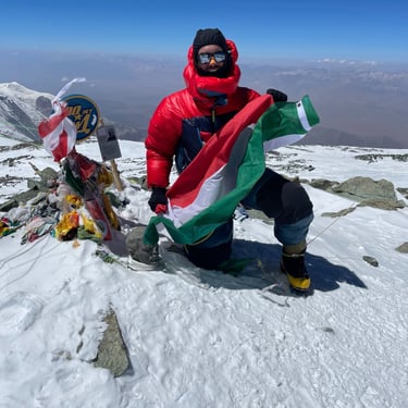
View from the summit
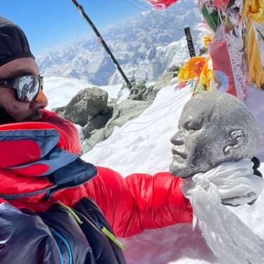
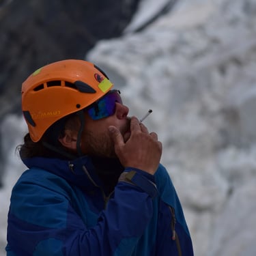
11+2 is my favorite number. 11 steps plus 2 then a short breath, repeat. Summit was crowded. Soon we joined. Tears, adrenaline, dopamine, euphoria... High fives, congratulations, hugs. Wind howled but I didn’t mind. Kneeling, kissed Lenin bust. Took Hungarian and Romanian flags given by dear friend Ernest at Camp One who couldn’t join due to illness. Promised to bring flags for him and fellow Romanian climbers as respect. Took summit photos. Did 20 push-ups. Tried lighting a cigarette from Thomas with a Sherpa brother, but wind too strong and tobacco damp :( Lay down, enjoyed summit. Felt great spending 30-35 minutes savoring every moment. The panoramic view was uplifting, stretching to Tajik giant peaks like Kommunizmus peak (7495m) and Korzenevskaya peak (7105m).**
Return to base camp
Halfway through. Yes, Lenin summit is at the first half. Still had to return to base camp. Long and exhausting route. Toes came back to life; this was more painful than immobility. Blood flow made it feel like standing in fire. Every moment hurt until reaching C3. But progress was slow. One Sherpa supported a bulky client in poor condition. I decided to accompany them for help if needed. We helped and moved together. The slowest part was descending from 6400m to the saddle. The tired client moved clumsily. From afar, we saw others waiting and another guy bringing tea in large thermoses. By 19:00 we enjoyed comfort and safety of tents again. Spent the night there. Was eager for morning to return to base camp and check on Lithuanian (Gediminas) and French (Valentin) ultrarunners met at C1. Later learned Gediminas completed BC-Lenin-BC route of 53.25km and 4164m+ in 22 hours 7 minutes. Incredible and inspiring. In morning I gave leftover food and bandages to Camp Three leader, then went mostly nonstop to about C1. Ate lunch, donned all gear, and continued to BC. Arrived, settled, and took a deserved hot shower—it was amazing... During dinner, summit certificates, shirts, and cake were distributed. We celebrated and rejoiced each other’s success. Bought a bottle of vodka in Osh saved for this. Romanian brothers offered brandies. Dinner celebration continued at a local bistro opened last year and fully operational this season. Inside was incredibly modern. Entering felt like a European luxury restaurant. Served various European beers and allowed brought drinks inside—a novelty for me. Many sherpas celebrated with us. A Romanian team member reached summit the same day as me. Didn’t expect that kind of celebration.
Fun facts
Team names during acclimatization:
Hungarian Team
Romanian Team
Zsolt
Why August 9?
I heard over the radio that the Romanian team planned their summit push that same day — and I decided to go for it too.
Raynaud’s syndrome:
Raynaud’s syndrome is a spasmodic, reversible contraction of blood vessels triggered by cold or stress, typically affecting fingers and toes. Symptoms include skin turning white, then purple, followed by redness upon blood return. Severe cases involve numbness, pain, and possibly ulcers.
Proper acclimatization
During high-altitude expeditions, proper acclimatization is essential. What is acclimatization? - It is the body’s adaptation process to the oxygen-deficient environment of high mountains. What are the benefits? - Proper acclimatization helps avoid unpleasant high-altitude illnesses such as severe, persistent headaches, shortness of breath, fatigue, loss of appetite, muscle pain, dizziness, nosebleeds, vomiting, high-altitude cerebral and pulmonary edema... not pleasant, so best avoided 😉. How to acclimatize well? - It’s a multifactorial process varying by individual, but important for everyone is to allow enough time for the body to adapt to decreasing atmospheric pressure with altitude. A proven method is the classic "Go high, sleep low!" Let’s see what else helps in a high-altitude expedition environment 🤔
Consume plenty of fluids (water and tea), 4-6 liters daily
Stay active even on rest days
Carry only essential gear on first acclimatization hikes (small backpack, few kg)
Don’t rush! As sherpas say: Slowly, slowly, but longly...
Replenish "energy stores" (carbs, protein)
Always sleep at lower altitude than the highest point reached that day
Acclimatization strategy on Lenin Peak expedition
First, a plan local agencies follow, then my own, which I think is even more reliable for a successful summit.
Local agencies’ acclimatization plan:
Day - Arrival in Osh. Transfer to Edelweiss Meadow base camp (3600m). Hike to Leek Meadow (3800m).
Day - Acclimatization around Edelweiss Meadow base camp (3600m): hike to a waterfall or to Puteshestvennikov Pass (4150m).
Day - Acclimatization around Edelweiss Meadow base camp (3600m): hike to ridge of Petrovskiy peak (approx. 4100m).
Day - Ascend to Camp One (4400m).
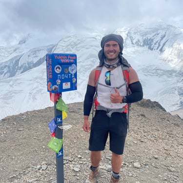
Day - Acclimatization around Camp One (4400m): glacier walk or climb Yukhin peak (5130m) then return to Camp One.
Day - Ascend to Camp Two (5300m).
Day - Ascend to Camp Three (6100m).
Day - Return to Camp One (4400m).
Day - Return to Edelweiss Meadow base camp (3600m).
Day - Rest day at Edelweiss Meadow base camp (3600m).
Day - Rest day at Edelweiss Meadow base camp (3600m).
Day - Ascend to Camp One (4400m).
Day - Ascend to Camp Two (5300m).
Day - Ascend to Camp Three (6100m).
Day - Summit attack on Lenin peak (7134m). Return to Camp Three (6100m).
Day - Return to Camp One (4400m).
Day - Return to Edelweiss Meadow base camp (3600m).
Day - Reserve day for bad weather.
Day - Transfer to Osh.
My own acclimatization plan:
Day - Arrival in Osh. Transfer to Edelweiss Meadow base camp (3600m). Hike to nearby waterfall (3800m).
Day - Acclimatization around Edelweiss Meadow base camp: hike to ridge of Petrovskiy peak (approx. 4100-4200m).
Day - Ascend to C1 (4400m).
Day - Climb Yukhin peak 5130m then return to C1.
Day - Return to Edelweiss Meadow base camp (3600m).
Day - Ascend to C1 (4400m).
Day - Ascend to C2 (5300m).
Day - Ascend to C3 (6100m) then return to C2.
Day - Return to Edelweiss Meadow base camp (3600m).
Day - Rest day at Edelweiss Meadow base camp (3600m).
Day - Rest day at Edelweiss Meadow base camp (3600m).
Day - Ascend to C1 (4400m).
Day - Rest day at C1 (4400m).
Day - Ascend to C2 (5300m) then to C2.5 (5800m) or C3 (6100m).
Day - Rest day at C3 (6100m), hike to 6200-6300m.
Day - Return to C2 (5300m).
Day - Ascend to C3 (6100m).
Day - Rest day at C3 (6100m).
Day - Summit attack on Lenin Peak (7134m). Return to Camp Three (6100m).
Day - Return to Edelweiss Meadow base camp (3600m) (joint celebration).
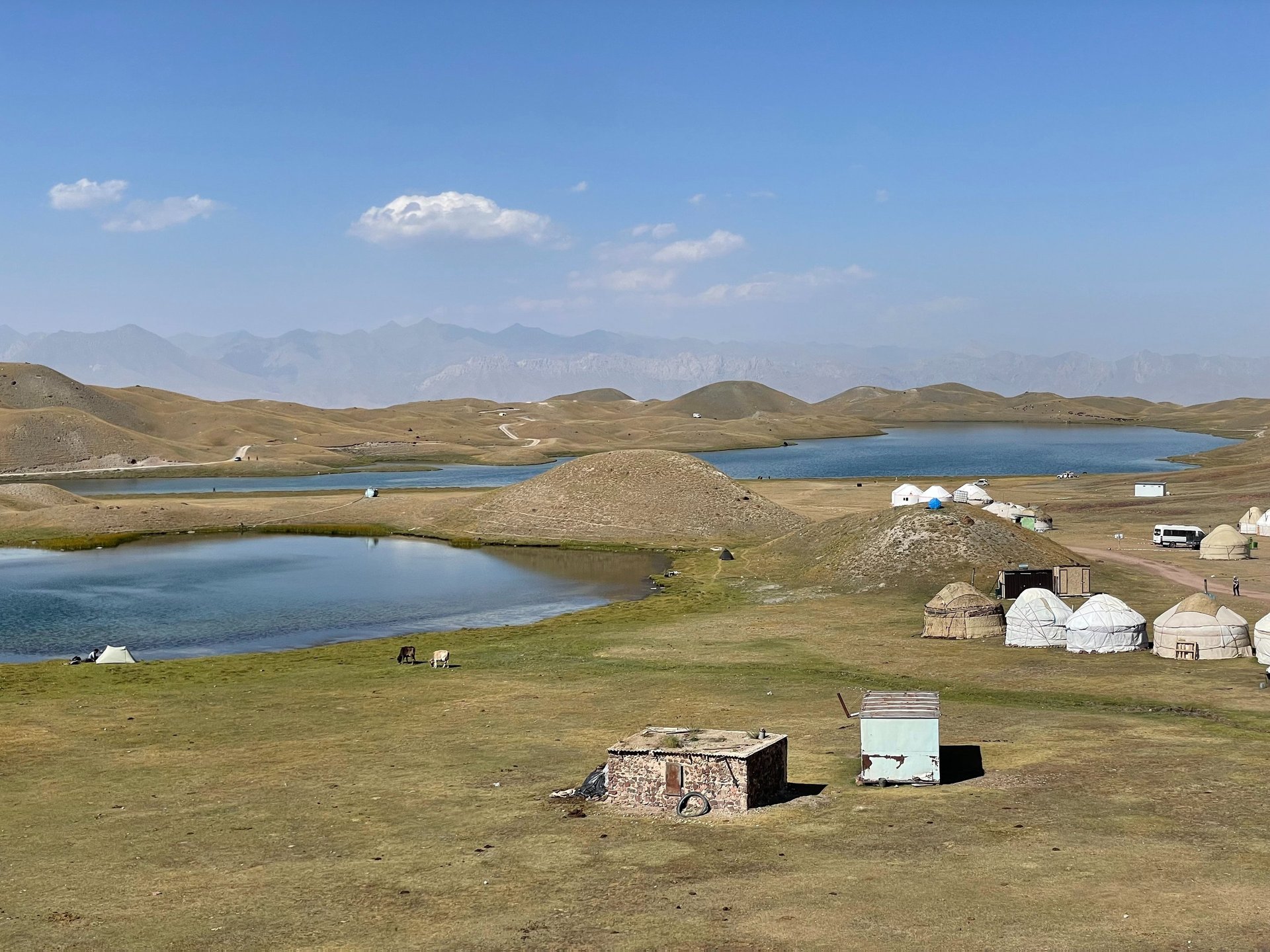
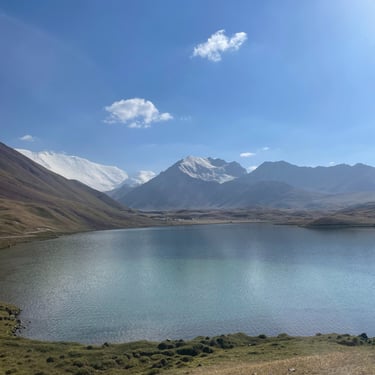
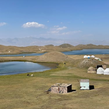
Day - Party day (hike to Tulpar-Kol lake to taste kumis).
Day - Reserve days.
Day - Reserve days.
Day - Reserve days.
Day - Transfer to Osh.
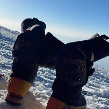
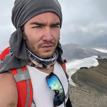
Gallery
PROJECT
Discover cycling adventures with us!
Contact
sUBSCRIBE
+36-20-929-7767
© 2025. All rights reserved.